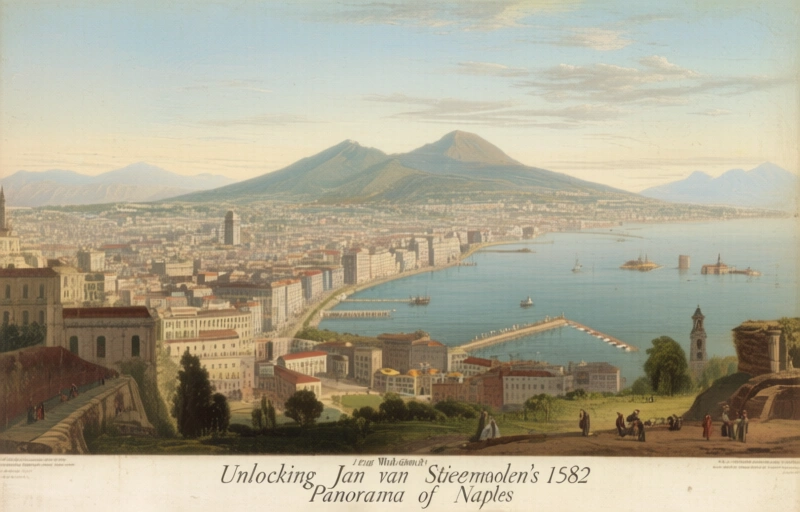
Unlocking Jan van Stinemolen's 1582 Panorama of Naples
Miguel Fernández ·
Listen to this article~5 min
Discover how a collaborative research project deciphered Jan van Stinemolen's 1582 Panorama of Naples, revealing it as a complex artistic construction, not a simple snapshot, using historical maps and critical analysis.
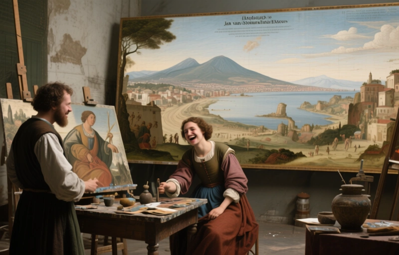
If you're like me, you've probably seen old maps and drawings and thought they were just simple records of a place. A snapshot in time, right? Well, that's what I thought too, until I dug into Jan van Stinemolen's *Panorama of Naples* from 1582. This isn't just a drawing. It's a complex, layered masterpiece that tells a story far deeper than its surface suggests.
A recent collaborative research project set out to crack its code. The goal was twofold, and honestly, both parts are fascinating. First, the team wanted to identify as many real-world locations as possible within the drawing. Think of it like a historical treasure hunt across a 440-year-old canvas. Second, they aimed to investigate the artistic composition itself—how it was put together and what mediums Stinemolen blended to create his vision.
### What Makes This Panorama So Special?
Let's get one thing straight from the start. Calling this work a "simple snapshot" does it a massive disservice. The research revealed it's anything but. Stinemolen wasn't just copying what he saw; he was constructing a narrative. He made deliberate choices about what to include, what to emphasize, and how to arrange the city's sprawling landscape across the paper. It's intermedial, meaning it pulls from different artistic traditions and techniques to build something entirely new for its time.
To tackle this, scholars didn't just stare at the drawing. They built what I like to call a "detective's toolkit." A core part of this was consulting a specialized bibliography. This wasn't just a list of books about the drawing itself. It included:
- Critical interpretations of Stinemolen's work and its place in art history.
- Studies on the techniques of panoramic drawing in the 16th century.
- References to digitized historical maps that were annotated by experts.
These annotated maps, many from the collections of the Bibliotheca Hertziana, were game-changers. They provided the crucial geographical keys to start matching Stinemolen's artistic vision with the actual streets, buildings, and vistas of 1582 Naples.
### The Collaborative Discovery Process
Imagine a group of historians, cartographers, and art experts all hunched over tables, comparing a fragile old drawing with digital maps on screens. That's the spirit of this project. It was a conversation across centuries. By overlaying Stinemolen's panorama with these precise historical maps, they began to see the method behind his artistry.
They could identify specific churches, fortifications, and natural landmarks. But more importantly, they could see where Stinemolen took artistic license. Where he compressed distance for effect. Where he altered perspective to guide the viewer's eye. This is where the project moved from cataloging sites to understanding genius. One researcher noted, "We stopped asking 'what is this building?' and started asking 'why did he choose to show it *this* way?'"
That shift in question is everything. It transforms the panorama from a historical document into a piece of persuasive visual rhetoric. Stinemolen was selling a version of Naples, one shaped by his perspective and intent.
### Why This Matters for Professionals Today
So, you might be thinking, "That's cool for art historians, but what's in it for me?" Here's the thing. This project is a masterclass in interdisciplinary research. It shows how blending resources—from physical bibliographies to digital assets—can solve problems that seem impossible at first glance.
The approach demonstrates a powerful workflow:
1. Define a clear, dual-purpose goal (identify *and* interpret).
2. Assemble a diverse toolkit (primary sources, critical literature, technical analysis).
3. Use modern technology (digitized maps) to interrogate an ancient artifact.
4. Let the findings from one goal inform the pursuit of the other.
For anyone working with historical visualization, urban studies, or cultural heritage, there's a blueprint here. It proves that the most enduring mysteries aren't solved by a single expert in a lonely library, but by teams connecting dots across different fields. The *Panorama of Naples* is more than a view of a city. It's a testament to what we can discover when we look at the past with fresh, collaborative eyes.