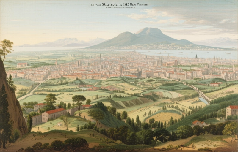
Jan van Stinemolen's 1582 Naples Panorama: A Hidden…
Miguel Fernández ·
Listen to this article~5 min
Discover Jan van Stinemolen's 1582 panorama of Naples, a unique land-view masterpiece that's finally getting the scholarly attention it deserves through digital mapping research.
Let's talk about a piece of art that's been hiding in plain sight. Back in 1582, a Dutch artist named Jan van Stinemolen did something pretty remarkable. He created this massive panorama of Naples, Italy. But here's the twist—it wasn't the typical postcard view from the water. Nope. He showed us the city from the land side, from the hills looking down. That's like seeing New York City from New Jersey instead of the Statue of Liberty. It gives you a whole different feel.
This incredible ink-on-paper drawing now lives at the Albertina Museum in Vienna. It's over 440 years old, measuring about 4 feet wide. You'd think something this unique would have art historians buzzing nonstop. But surprisingly, it hasn't gotten the deep dive it deserves. Scholars of Italian topography know about it. Experts in Dutch drawing techniques know about it. Yet somehow, it's stayed in this weird scholarly limbo.
### Why This Drawing Matters Today
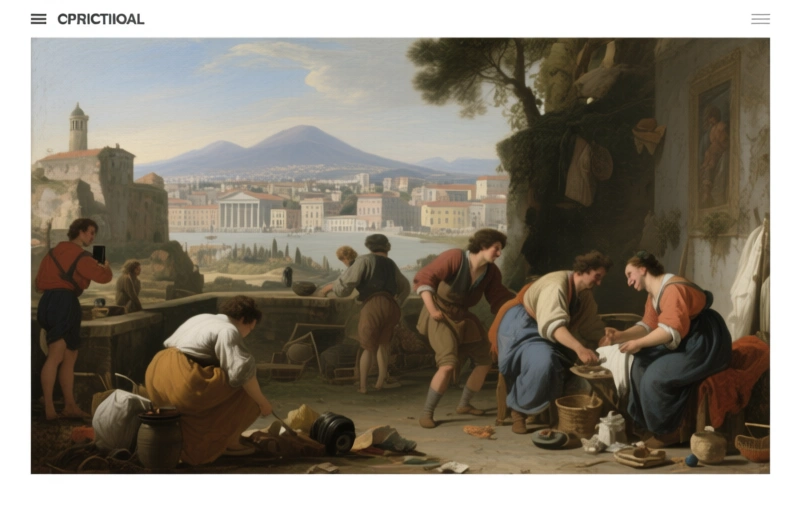
What makes Stinemolen's work so special isn't just the unusual perspective. It's how he blended city and countryside, culture and nature, into one cohesive image. He wasn't just documenting buildings. He was telling a story about how the urban landscape met the rural world. Think about that for a second. In the 16th century, this was a pretty sophisticated way of seeing a place.
Recently, a team of researchers decided to finally give this masterpiece the attention it warrants. They launched a collaborative project using some seriously cool tools. Their secret weapon? Digitized historical maps from the Bibliotheca Hertziana – Max Planck Institute for Art History. By overlaying these annotated maps with Stinemolen's drawing, they could start solving its mysteries.
### Decoding a 16th-Century Vision
The research had two main goals. First, they wanted to identify as many locations in the drawing as possible. Where exactly was Stinemolen standing? Which churches, forts, and villages was he depicting? Second, they needed to understand his artistic choices. How did he compose this scene? What techniques did he use to create depth and perspective?
What they discovered was fascinating. This wasn't just a simple snapshot of Naples in 1582. It was a carefully constructed piece of visual storytelling. Stinemolen made deliberate choices about what to include, what to emphasize, and how to arrange elements across the 4-foot span of paper.
Here's what makes his approach so interesting:
- He combined multiple viewpoints into one coherent scene
- He balanced architectural precision with natural landscape elements
- He created a narrative flow that guides the viewer's eye across the panorama
- He documented a moment of transition between medieval and Renaissance city planning
One researcher noted, "This drawing isn't just a map or a view. It's a philosophical statement about how humans inhabit space." That's pretty deep for something created with ink and paper.
### The Tools That Changed Everything
The digital mapping technology used in this project was game-changing. Researchers could zoom in, overlay historical data, and compare Stinemolen's rendering with known landmarks. They could trace his likely path through the Neapolitan hills. They could even estimate the time of day based on shadow angles in the drawing.
This approach revealed how Stinemolen might have worked. He probably made multiple sketches from different vantage points. Then he synthesized them back in his studio, creating this unified vision. The drawing shows both intimate details—like individual trees and buildings—and sweeping vistas of the Bay of Naples in the distance.
### What We Can Learn From This
For professionals in historical visualization and urban studies, Stinemolen's work offers valuable lessons. It shows how artistic interpretation can reveal truths that straight documentation might miss. The drawing captures the essence of Naples in 1582—its textures, its rhythms, its relationship with the surrounding landscape.
This research project proves that sometimes, you need fresh eyes and new tools to appreciate old masterpieces. By combining art historical analysis with digital mapping, the team uncovered layers of meaning that had been overlooked for centuries. They showed that Stinemolen wasn't just drawing what he saw. He was interpreting how the city lived and breathed within its natural setting.
So next time you look at an old map or panorama, remember there might be more there than meets the eye. Just like Stinemolen's Naples, some treasures wait patiently for the right moment—and the right tools—to reveal their full story.