Jan van Stinemolen's 1582 Naples Panorama: A Hidden View
Miguel Fernández ·
Listen to this article~4 min
In 1582, Jan van Stinemolen drew Naples from the hills, not the sea. This unique panorama, long overlooked, is now being reinterpreted using digital maps, revealing it as a complex artistic interpretation, not just a simple snapshot.
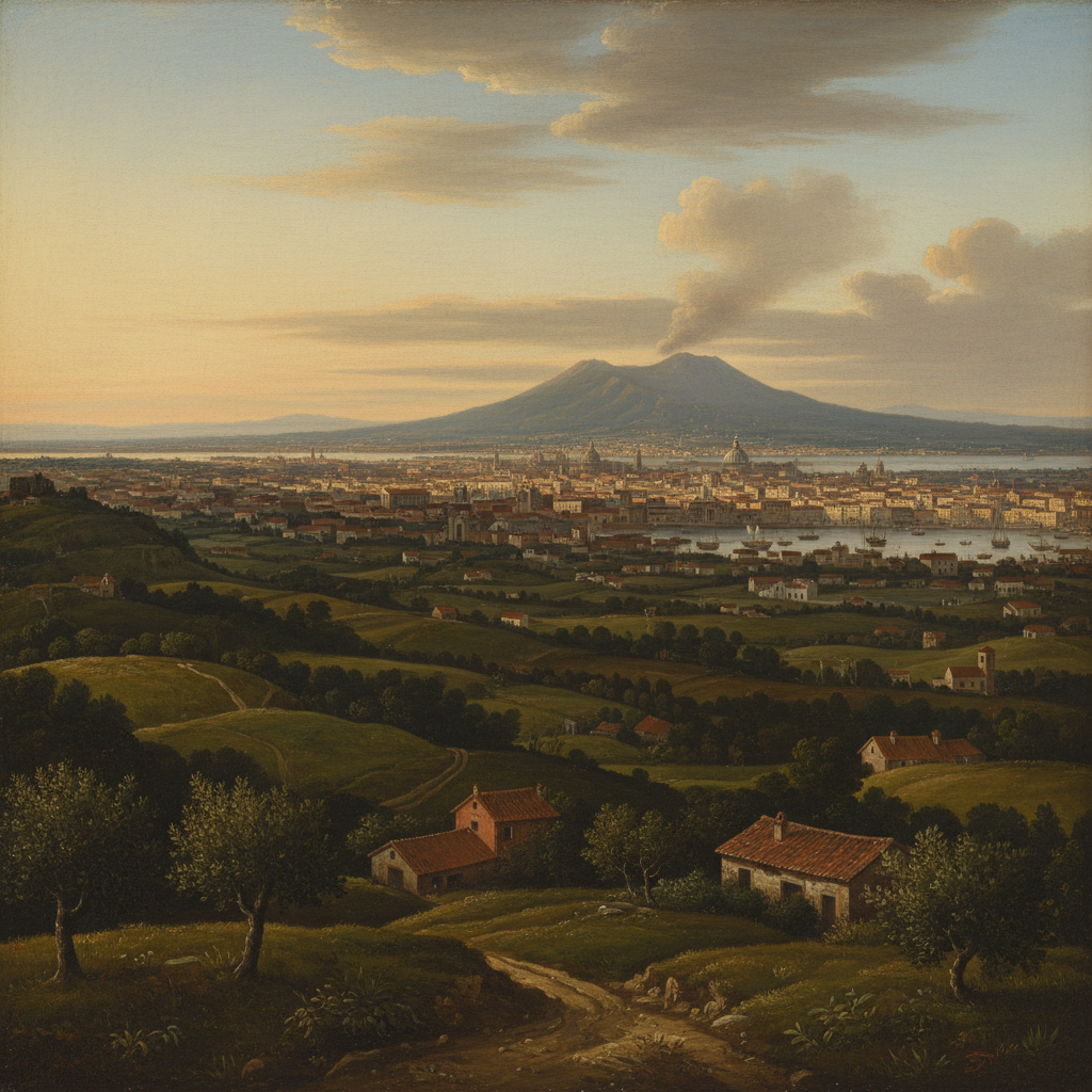
Back in 1582, a Dutch artist named Jan van Stinemolen did something pretty remarkable. He created a massive, detailed panorama of the city of Naples. But here's the twist—it wasn't the view everyone was used to seeing. Most artists painted Naples from the water, showing the famous gulf. Stinemolen flipped the script. He drew it from the land, looking out from the hills. This original piece, an ink-on-paper masterpiece, now lives in Vienna's Albertina museum. And honestly, it hasn't gotten nearly the attention it deserves.
It's well-known among a certain crowd—scholars who study Naples's landscape and experts in Dutch drawing techniques. But for such a unique work, there hasn't been a deep dive into what it really means. That's finally changing. A new collaborative research project is using some pretty cool modern tools to give this 440-year-old drawing a fresh look. They're aiming to solve its mysteries and show us why it's so much more than just an old map.
### What Makes This View So Special?
Think about the classic postcard view of a city. For Naples, it's always been from the sea. Stinemolen's decision to draw from the mainland hills was a radical departure. It shows the city in conversation with its countryside—the urban bustle right next to rolling hills and farmland. This perspective blends culture and nature in a single frame. It makes you wonder what he was trying to say. Was he more interested in how the city fit into the land, rather than how it presented itself to sailors and traders? This unique angle is the drawing's first major claim to fame.
### How Digital Tools Are Unlocking History
The big breakthrough in understanding this work came from digitized historical maps. Researchers at the Bibliotheca Hertziana – Max Planck Institute for Art History annotated these maps, creating a digital resource that was crucial. By overlaying Stinemolen's drawing with these detailed maps, they could start identifying specific sites. It's like detective work, piecing together a 16th-century puzzle. The project had two main goals:
- To pinpoint as many locations in the drawing as possible.
- To analyze its artistic composition—how it was put together.
This analysis revealed something important. This isn't a simple snapshot. It's a carefully constructed piece of art. Stinemolen made choices about what to include, what to emphasize, and how to arrange the scene. It's an interpretation, not just a recording.
### Why This Matters for Us Today
You might ask, why does a old drawing of Naples matter now? Well, it shows us how people saw and understood cities centuries ago. It's a record of a perspective that got overshadowed by the more common seaside views. Rediscovering it corrects the historical record. It also shows the power of collaboration and new technology. Old art and new digital tools can have a fantastic conversation, revealing secrets we never knew were there.
As one researcher noted, "This work forces us to reconsider the relationship between a city and its hinterland in the early modern imagination."
In the end, Jan van Stinemolen's 1582 panorama is getting its moment. It's a reminder that sometimes the most fascinating views are the ones taken from the road less traveled. By looking from the hills, he gave us a completely different Naples—one that's finally being seen and understood on its own terms.