Jan van Stinemolen's 1582 Naples Panorama: A Hidden View
Miguel Fernández ·
Listen to this article~4 min
Discover Jan van Stinemolen's 1582 panorama of Naples, a unique mainland view that redefines the city's relationship with its countryside, now explored through new digital research.
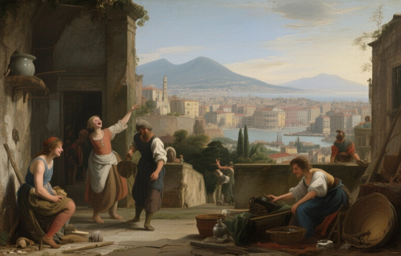
Back in 1582, a Dutch artist named Jan van Stinemolen did something pretty radical. He didn't just draw another pretty picture of Naples from the water, like everyone else. Nope. He climbed up into the hills and gave us a view from the *mainland*. It's a massive ink-on-paper panorama, and today it lives in the Albertina Museum in Vienna. But here's the crazy part—even though scholars who study Naples maps and Dutch art know about it, this piece hasn't gotten the deep dive it truly deserves. It's been sitting there, waiting for someone to really look at it.
### Why This Drawing Is Different
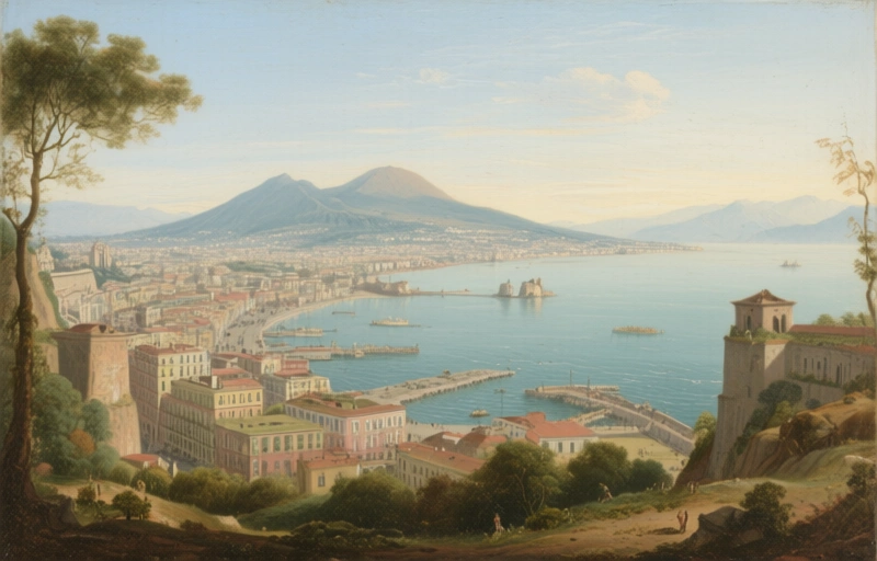
Think about all the classic paintings of Naples. They're almost always from the sea, right? The bay, the water, the classic postcard view. Stinemolen flipped the script. His perspective is from the land looking *toward* the city and the sea beyond. This wasn't just an artistic choice; it was a statement. It shows the city in relation to its countryside—the farms, the hills, the roads leading in. It connects urban life with the natural world around it in a way those sea-view paintings simply couldn't.
For a long time, people might have seen this as just a detailed, if unusual, snapshot. But new research is showing it's so much more than that. A collaborative project decided to finally give this work the attention it needed. They didn't just stare at the drawing harder. They brought in some serious digital firepower.
### The Digital Detective Work
The key to unlocking this drawing's secrets was a treasure trove of digitized historical maps from the Bibliotheca Hertziana. Researchers could overlay, compare, and annotate these old maps with Stinemolen's panorama. This wasn't about finding a perfect match, but understanding his *process*. What was he trying to show us?
Their mission had two clear goals:
- Pinpoint as many real locations in the drawing as possible. Which church is that? Is that road still there?
- Figure out how Stinemolen *built* this image. How did he compose it? What artistic tricks did he use?
What they found was fascinating. This isn't a photographically accurate record. It's a constructed, artistic vision. Stinemolen was making choices—emphasizing some things, minimizing others. He was telling a story about Naples as a place where city and country met.
### What We Can Learn From This View
So, why should we care about a 440-year-old drawing? It gives us a unique window into how people saw their world. Before satellites and Google Earth, drawings like this were how you understood geography and your place in it. For professionals studying historical landscapes or urban development, this is gold. It shows:
- The historical relationship between a major city and its agricultural hinterlands.
- How artists translated a sprawling, three-dimensional reality onto a flat page.
- The blending of artistic license with topographic observation.
It reminds us that every map, every panorama, has a point of view—literally and figuratively. Stinemolen chose to show us Naples not as a jewel from the sea, but as a living organism rooted in its land. That changes everything.
In the end, this research project did more than just analyze a cool old drawing. It highlighted how combining traditional art history with modern digital tools can breathe new life into forgotten masterpieces. It proves that sometimes, to see a city clearly, you need to change your vantage point entirely. Stinemolen knew that in 1582, and we're just now catching up.